Sediment transport study for the Karkinagri fishing port expansion
The sediment transport study is supporting the project entitled "Technical studies for the extension of the fishing port of Karkinagri, Ikaria", commissioned to CNWAY in May 2010.
Scope
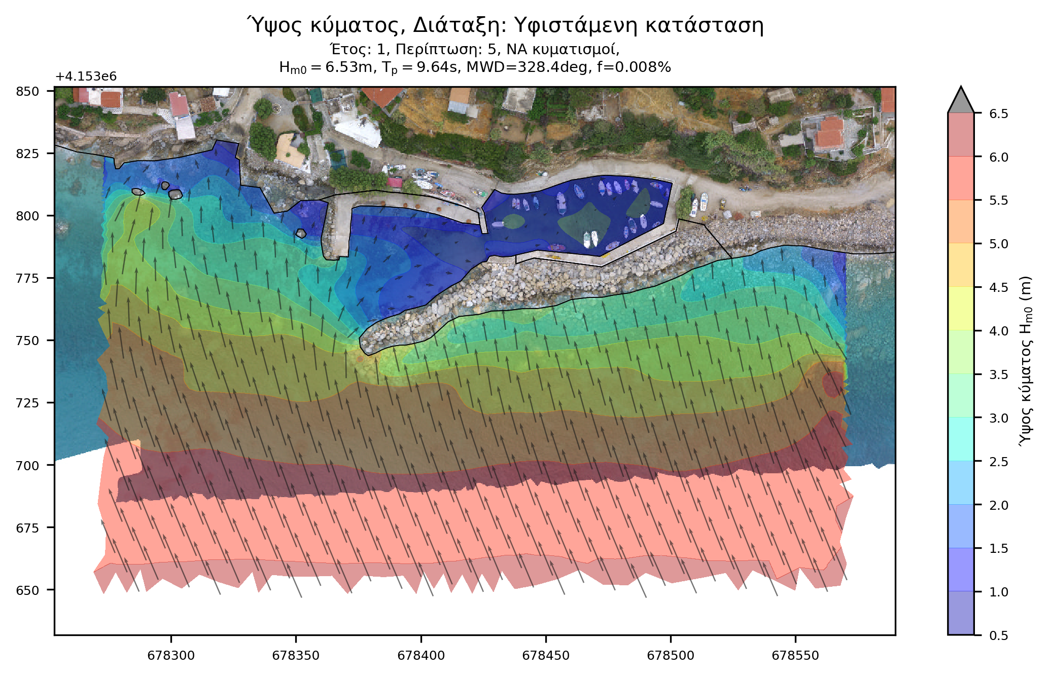
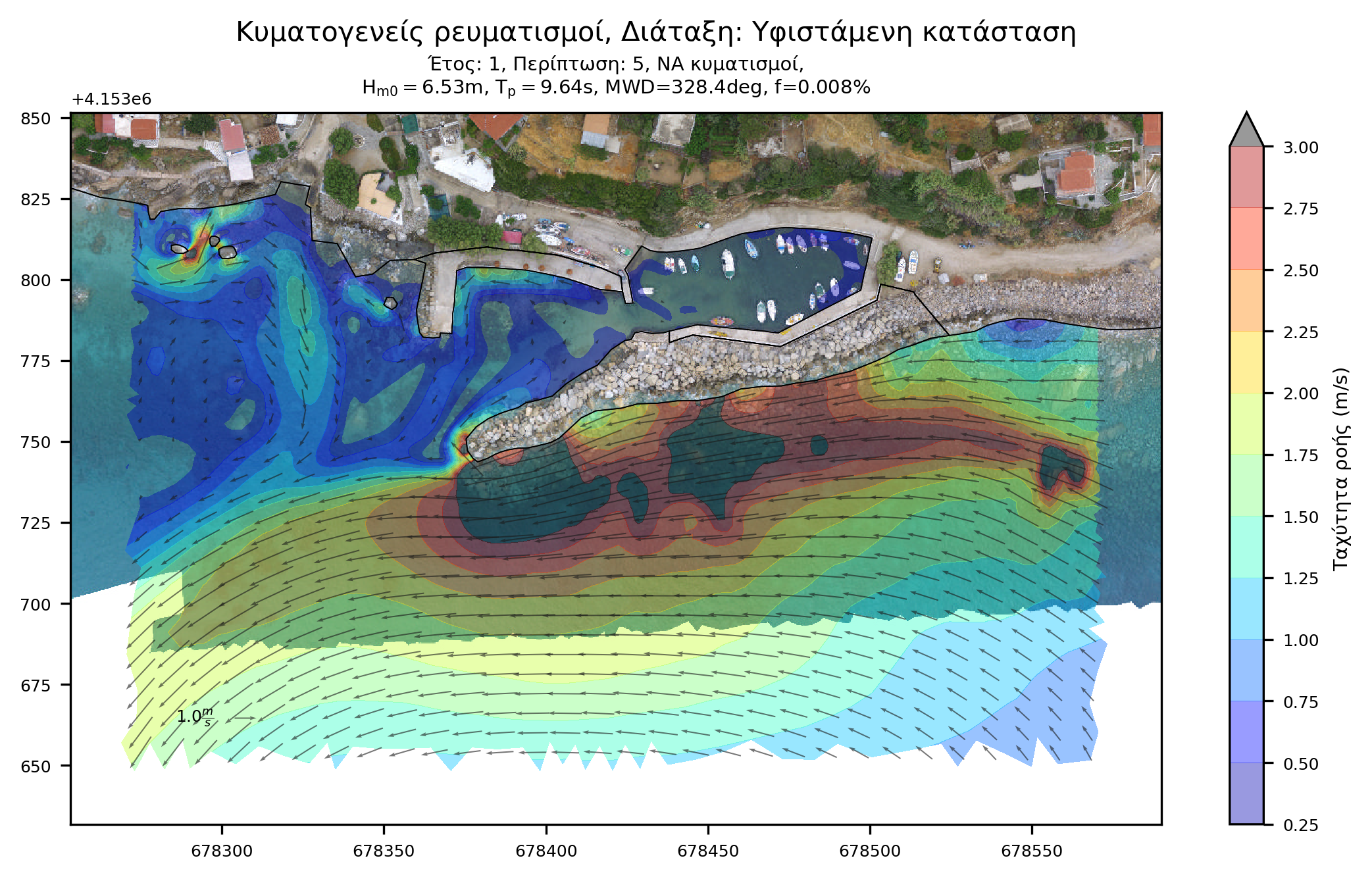
The scope of this coastal engineering study waw to assess the efficiency of the existing and proposed works layout with regards to preventing:
- Potential siltation in the port basin.
- Potential morphological changes in the adjacent coastlines.
The use of a numerical model enables the simulation of coastal and sediment transport processes thereby predicting morphological evolution. Therefore, its role is central to a coastal engineering study.
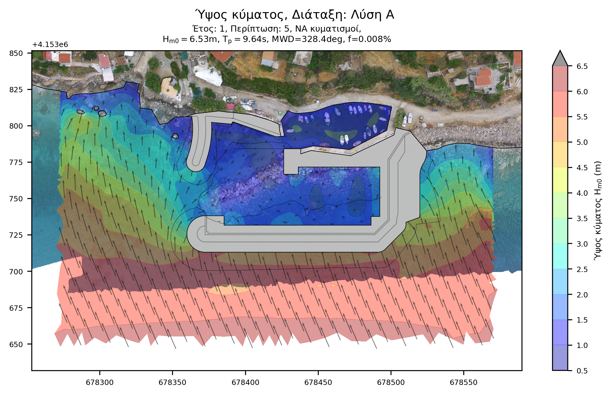
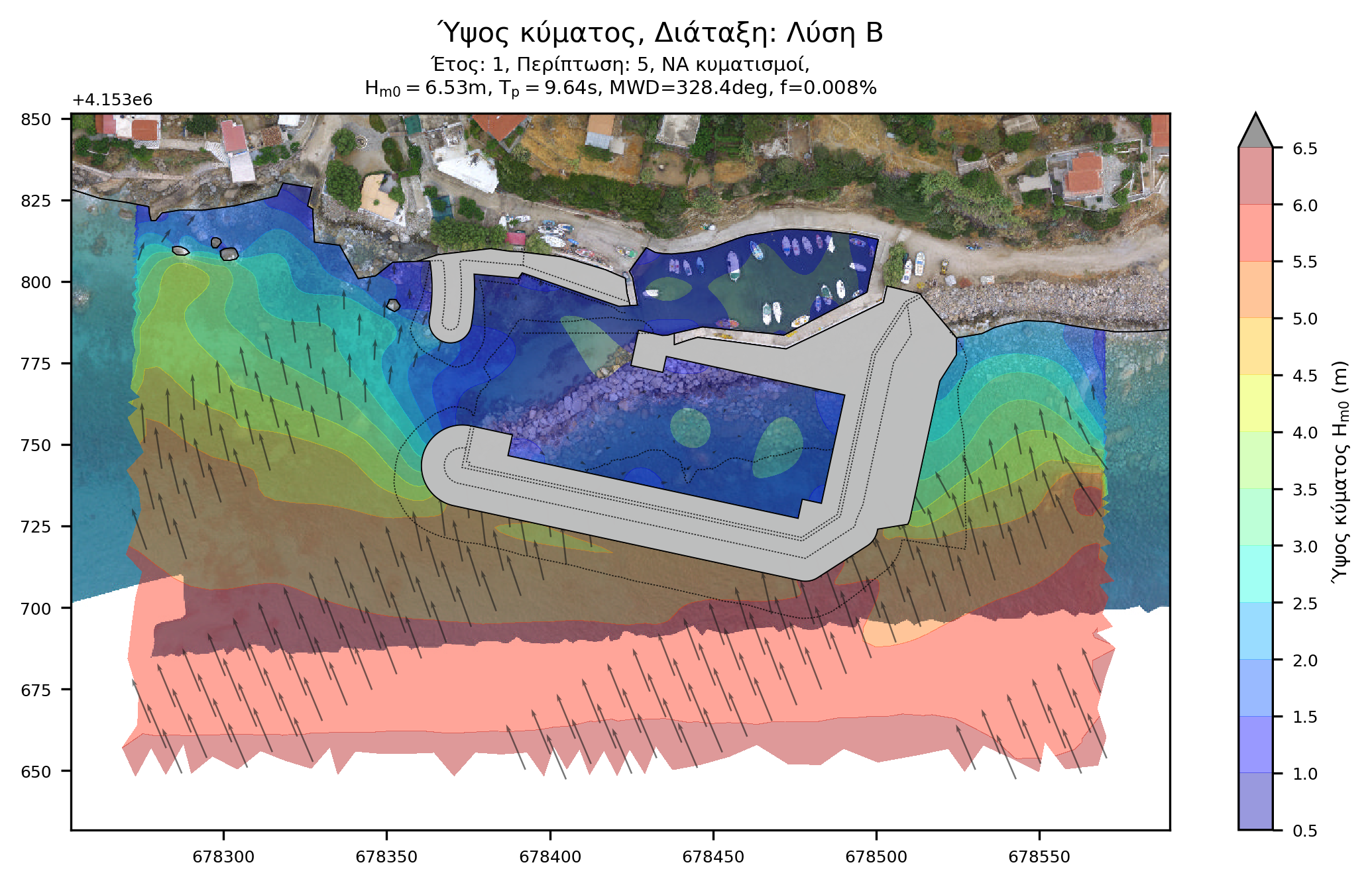
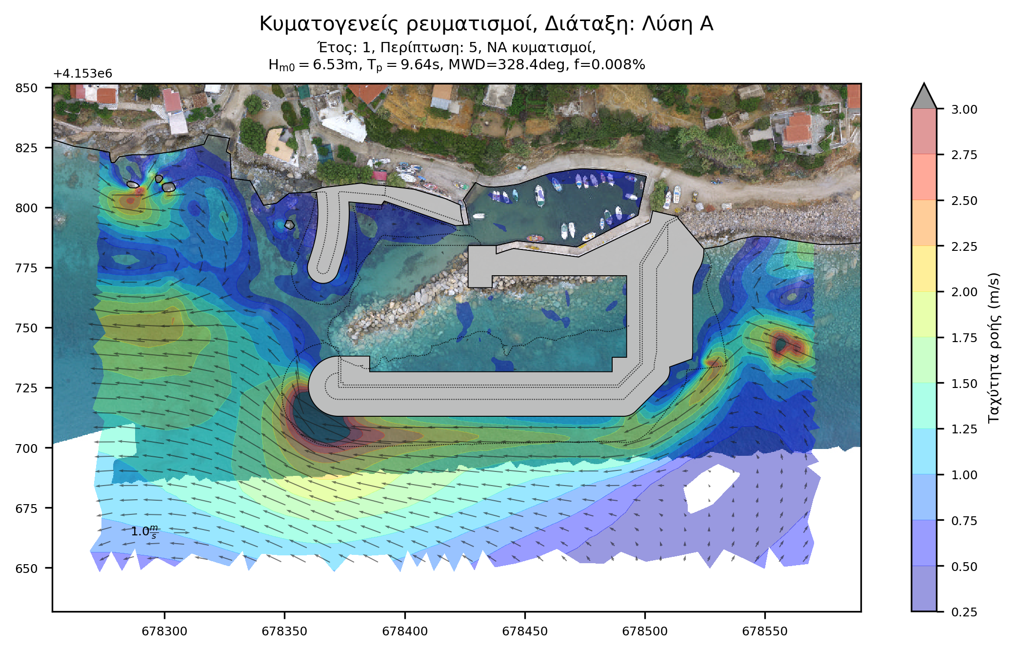
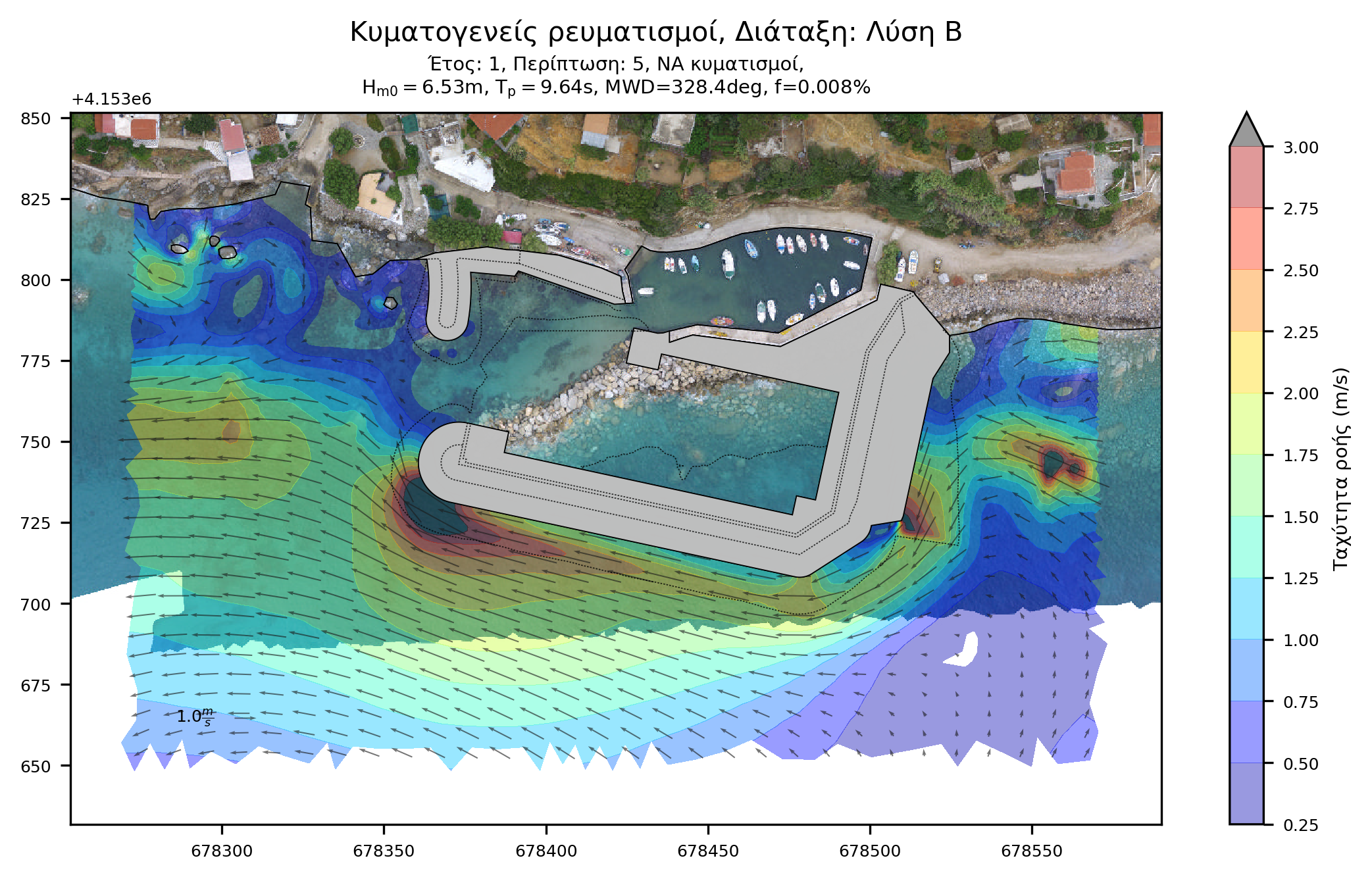
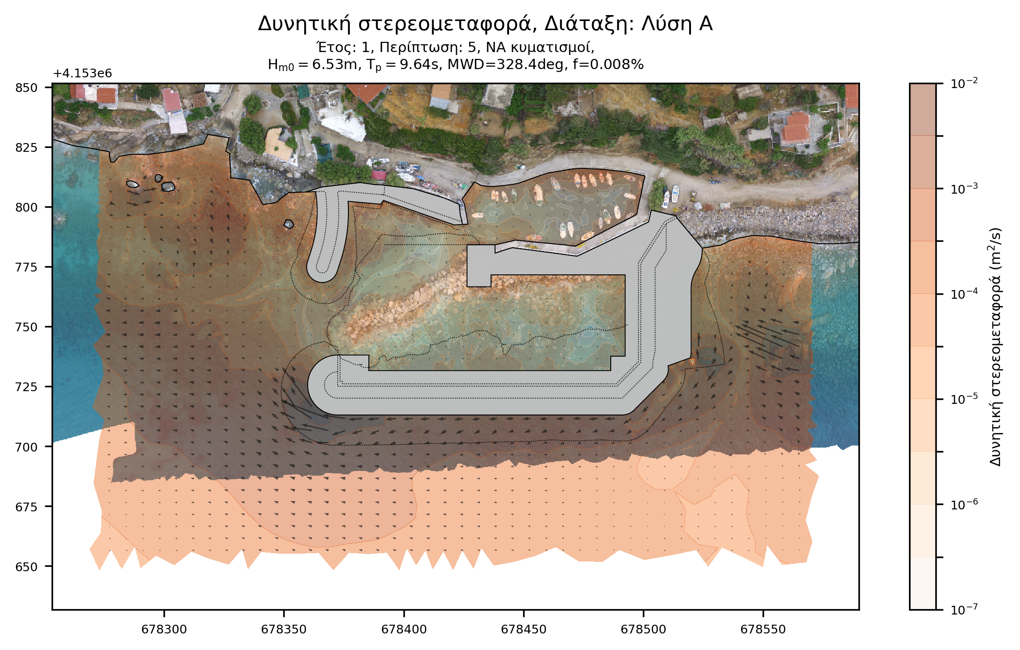
Alternative layouts
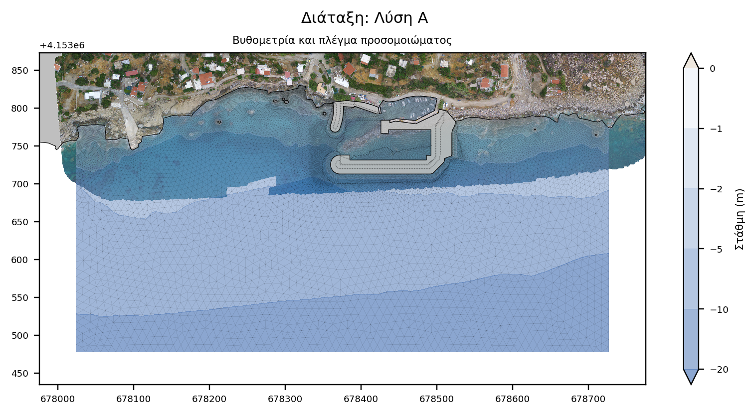
The most prevalent solutions are examined here, as evaluated by the Preliminary study of port works, i.e. Layout A and B.
Layouts B, C and D have the same entrance orientation and similar layout of exterior works. The most substantial difference from a coastal engineering point of view, is the length of the leeward pier (20 meters for Layout B and 11 for Layout C and D). It can therefore be expected that Layouts C and D will have similar or worse response compared to Layout B.
Numerical modeling
Offshore sediment transport was performed with the TMS (Telemac-Mascaret System) computing suite based on the coupling of individual models of wave propagation (TOMAWAC and ARTEMIS), wave-induced currents (TELEMAC2D) and sediment transport (SISYPHE).
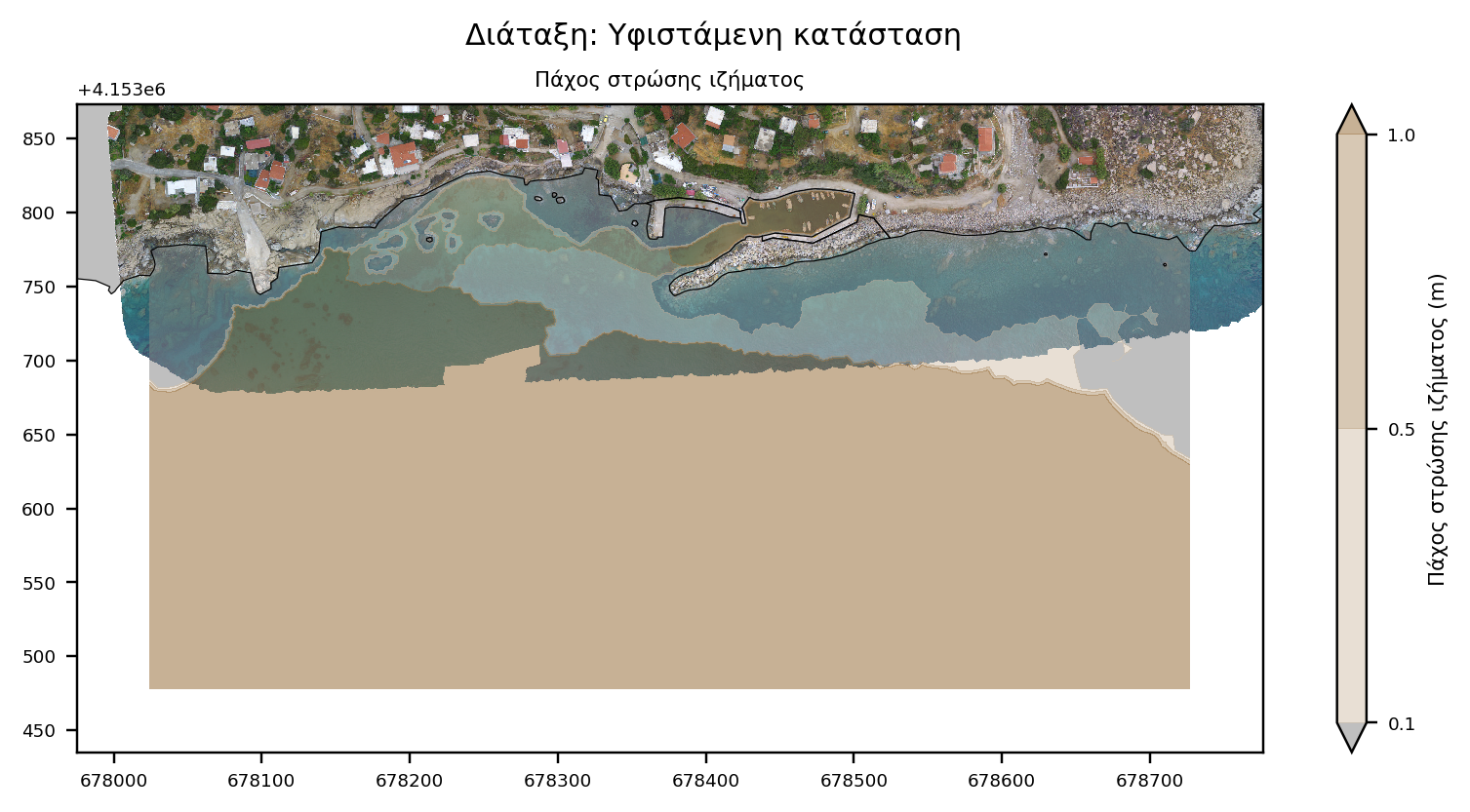
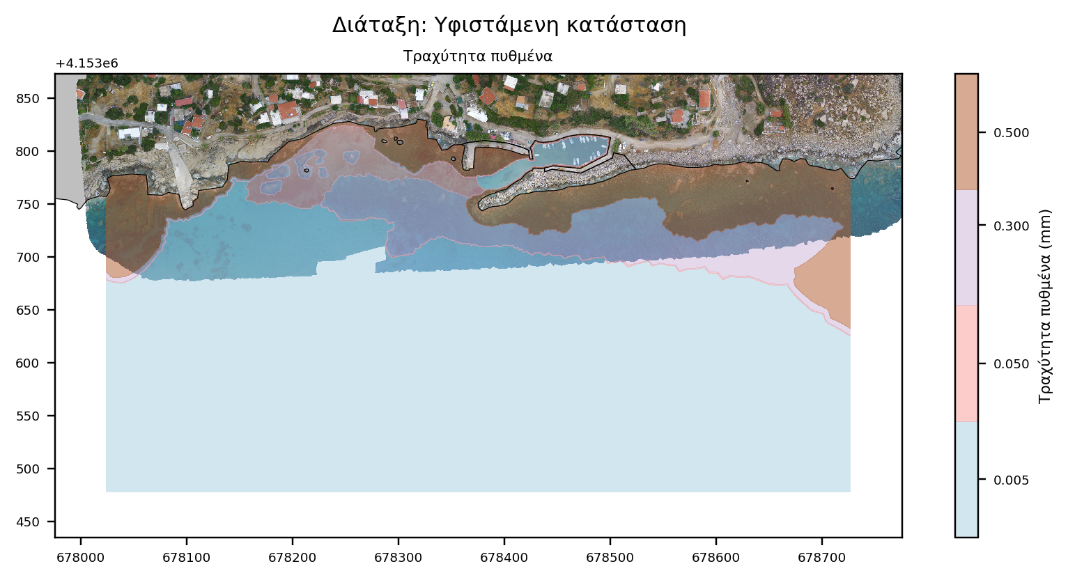
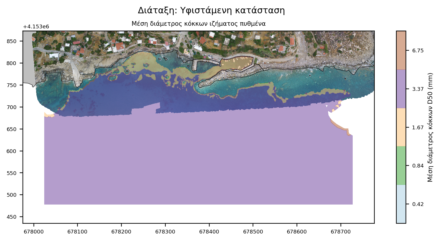
Model parameterization requires the input of sediment grading, spatial distribution and availability, as well as the spatial distribution of the corresponding friction coefficients based on the seabed texture. The spatial distribution map was created by combination of remote-sensing techniques and an appropriate on-site survey and sampling program. Specifically, the following supportive activities were carried out:
- shoreline investigation
- seabed sediment sampling at varying depths
- bathymetric and topographic survey
- photographic documentation / Aerial mapping
- marine vegetation mapping
- wind-wave climate estimation
Meticulous parameterisation ensures more accurate modeling of physical processes, enhancing the reliability of the analysis results.
Numerical model characteristics
The model consists of 2 sub-models, 'offshore' and 'nearshore'. The 'offshore' extends from the offshore wave position (WAM wave model node) to the shore, and its role is to prescribe wave and current boundary conditions for the 'nearshore' model. The 'nearshore' model is a subset of 'offshore' and this nesting aims to reduce computational effort.
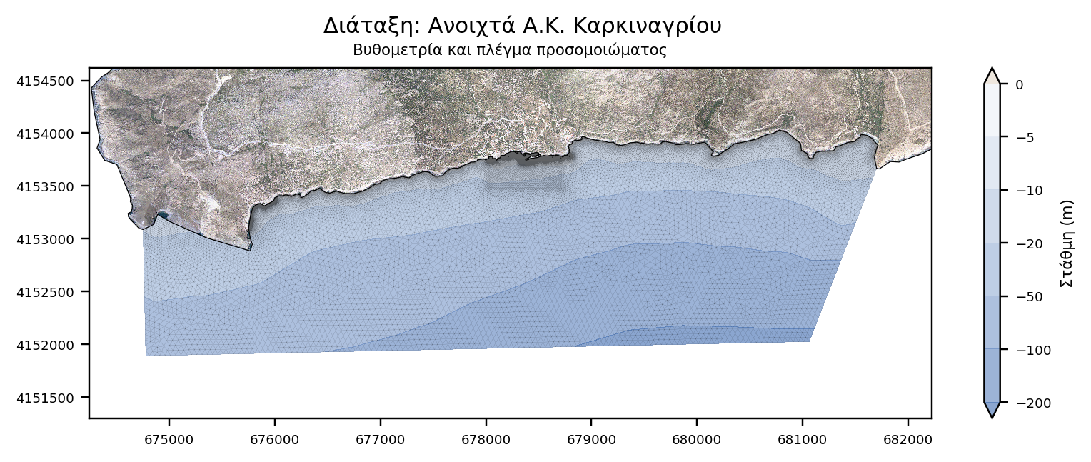

- Offshore model: It extends 7,0km along the E-W axis and 2,0 km laterally. It covers an area of approximately 11,1 km2 and consists of 109,000 elements and 56,000 nodes.
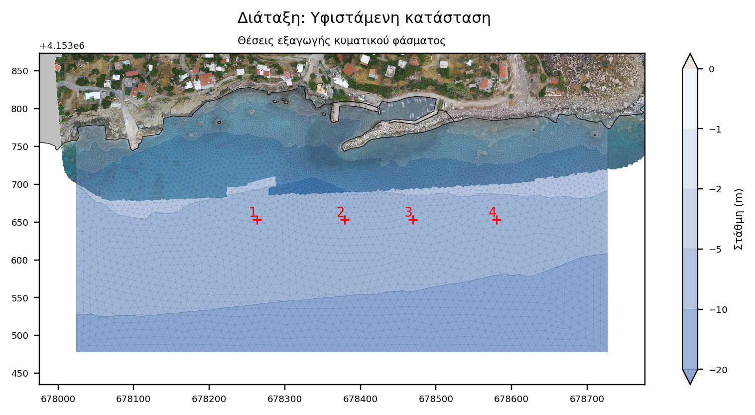
- Nearshore model: It extends 700 meters along the E-W axis and 350 meters laterally. It occupies an area of approximately 54 acres. and consists of about 65,000 elements and 33,000 nodes.
- Wave disturbance model: It extends 320 meters along the E-W axis and 170 meters laterally. It covers an area of about 11,4 acres and consists of about 159,000 elements and 80,000 nodes.
Wave climate
The wind and wave climate of the project is derived from the Skiron and WAM model respectively for the period 2001-2010.
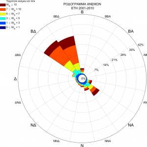
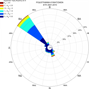
Initially, wave directions were divided into 45 ° sectors and wave height values were divided into 0.5 meter bins. Very low waves were excluded while very high were aggregated due to the very low frequency of occurrence.
Subsequently, the directional sectors that did not affect the study area were excluded. For the remaining directional sector-wave bin combinations, the equivalent wave height (representative of the wave state on a yearly basis) was calculated.
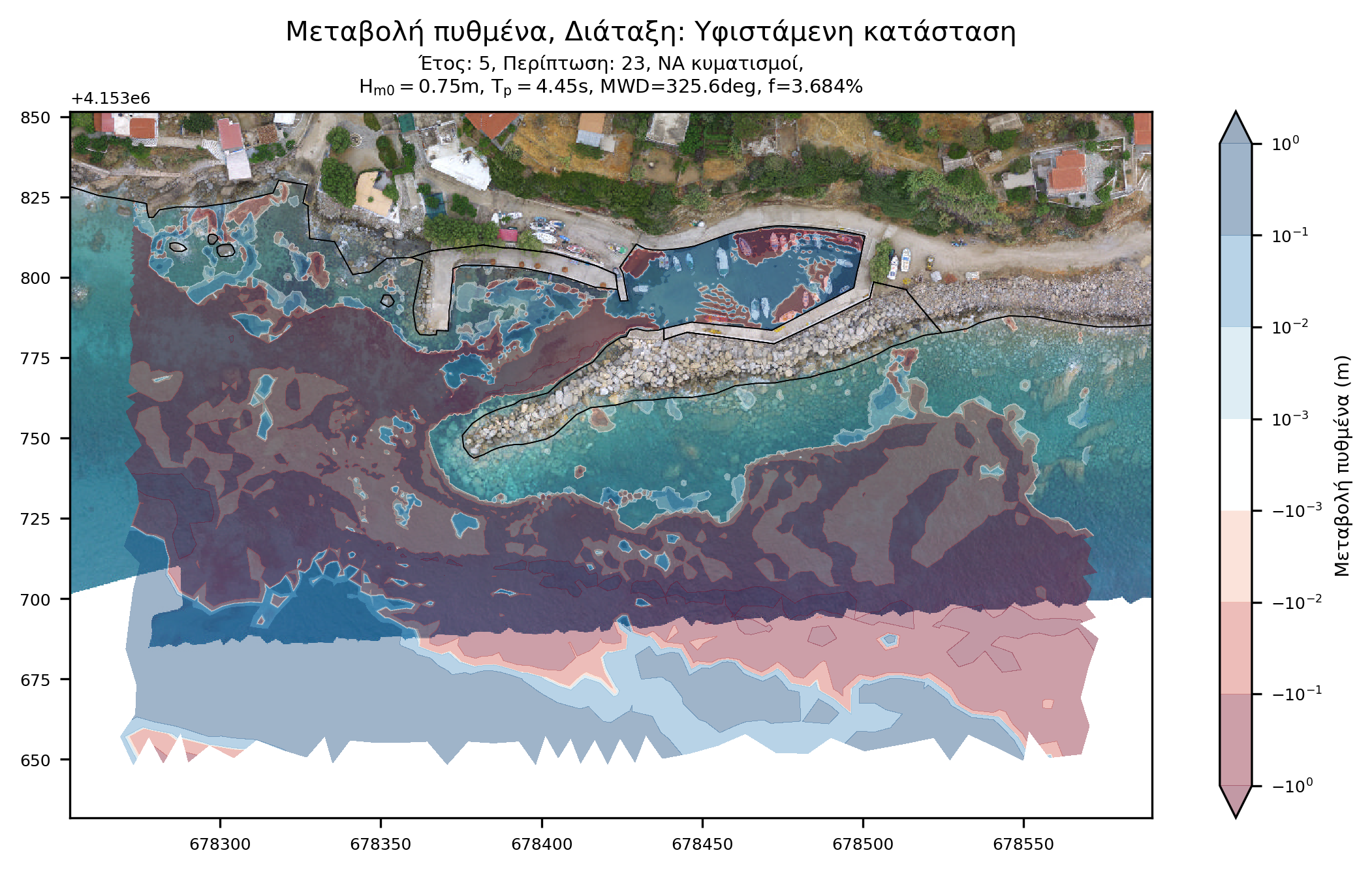
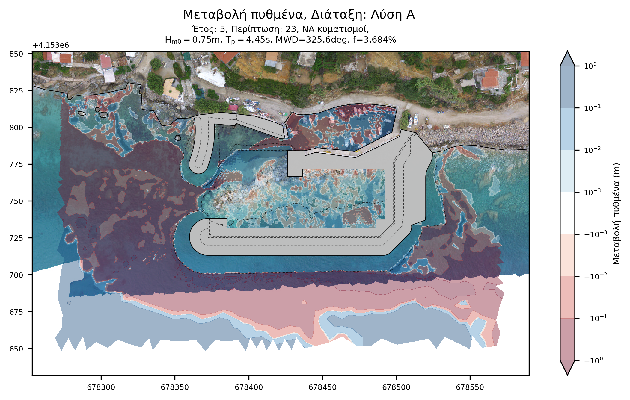
The wave cases were examined sequentially so that changes in bottom morphology are taken into account in the next case. The procedure was repeated 5 times, to simulate bottom change over 5 years.
Conclusion
It was observed that the proposed projects reduce the (already small) amount of sediment that bypasses the port. This is not expected to affect the coastal zone as the high wave potential will eventually sweep the sediment offshore, whether it resides upstream or downstream.
Both alternatives considered exhibit satisfactory performance. Layout B allows a larger amount of sediment to bypass the works, although this has been found to be of little importance in the coastal zone where the project is located. In addition, it allows a smaller amount of sediment to enter the existing/inner basin, which in absolute volume is small for both solutions.
In conclusion, Layout B is selected as it exhibits slightly better performance.