Sediment transport study at the location of Avantis Hotel Suites in Eretria, Evia
In November 2016, the management of the hotel complex "Avantis Suites Hotel", commissioned CNWAY to prepare all the required studies and research for the nourishment and protection of its hotel beach front in Eretria, Evia.
Coastal investigation
The coastal investigation carried out in the area, identified the following:
- The shoreline in front of the hotel is eroding and requires annual maintenance to maintain a minimum width to serve the hotel's customers
- The complete retreat of the hotel shoreline is limited by the existence of rocky outcrops that act as a deterrent
- The coastline to the southwest of the hotel shows strong signs of erosion.
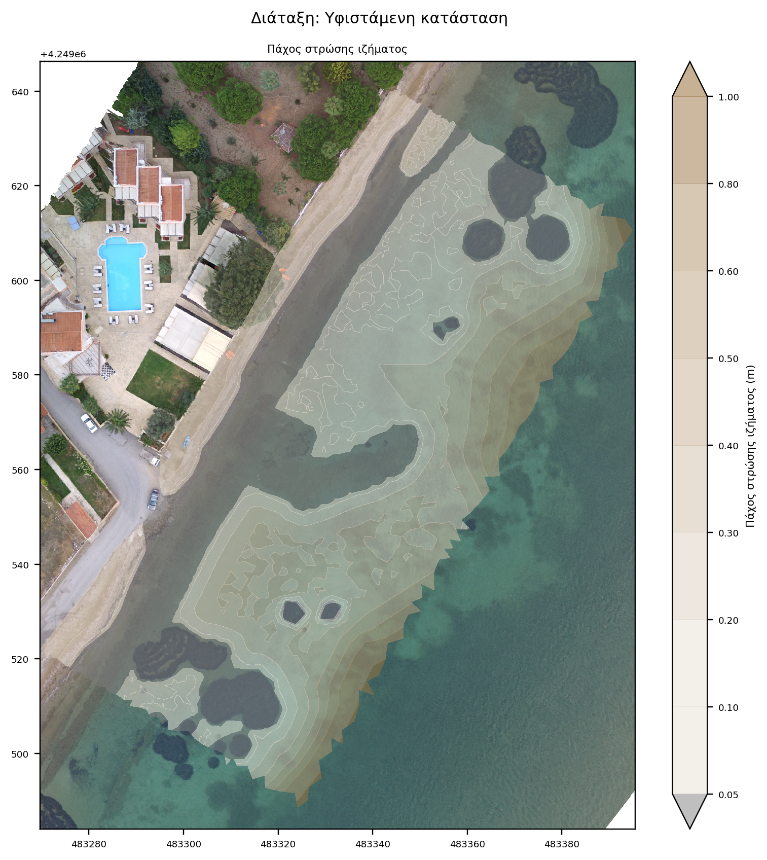
- There is no sediment available at the bottom to a depth of 1.0 meter, while deeper where visible it is fine-grained and contains slurry fractions.
Numerical modeling
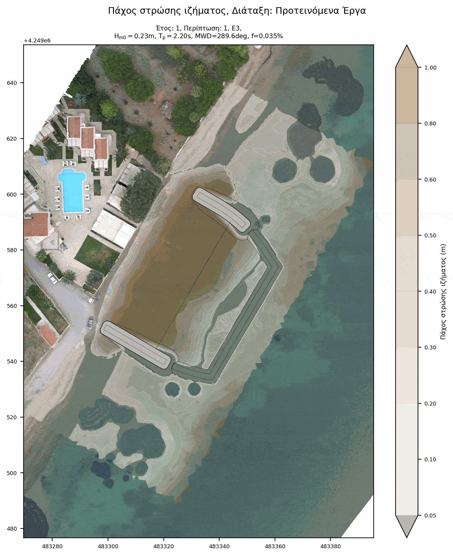
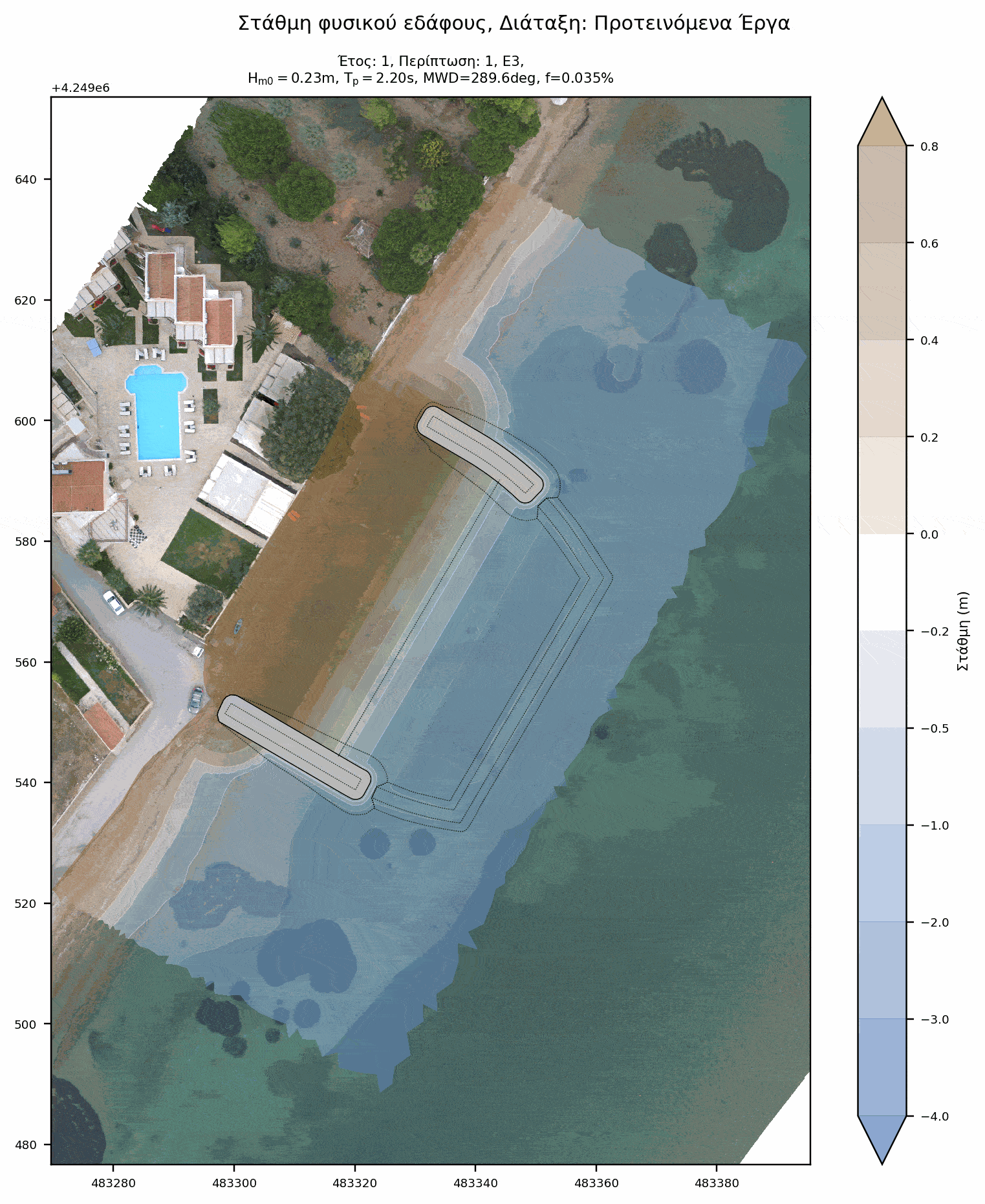
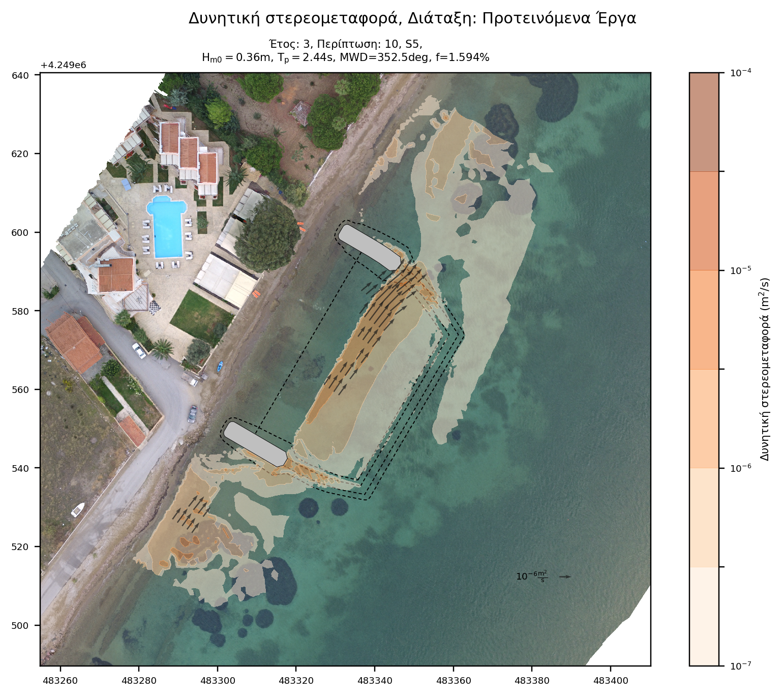
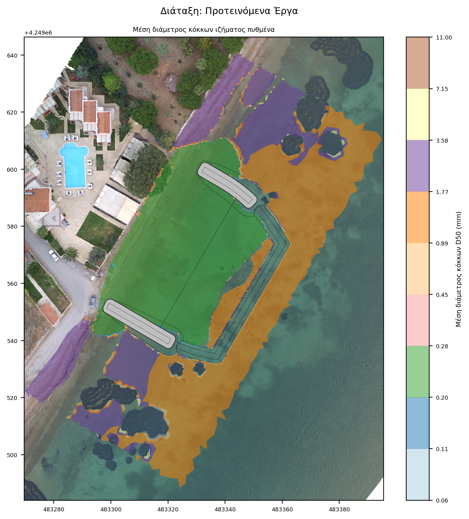
Coastal sediment transport was performed with the TMS (Telemac-Mascaret System) computing suite based on the coupling of individual models of wave propagation (TOMAWAC and ARTEMIS), wave-induced currents (TELEMAC2D) and sediment transport (SISYPHE). Model parameterization requires the input of sediment grading, spatial distribution and availability, as well as the spatial distribution of the corresponding friction coefficients based on the seabed texture. The spatial distribution map was created by combination of remote-sensing techniques and an appropriate on-site survey and sampling program.
Specifically, the following supportive activities were undertaken:
- shoreline investigation
- seabed sediment sampling at varying depths
- bathymetric and topographic survey
- photographic documentation / Aerial mapping
- marine vegetation mapping
- metocean analysis
Meticulous parameterisation ensures more accurate modeling of physical processes, enhancing the reliability of the analysis results.


Numerical model characteristics
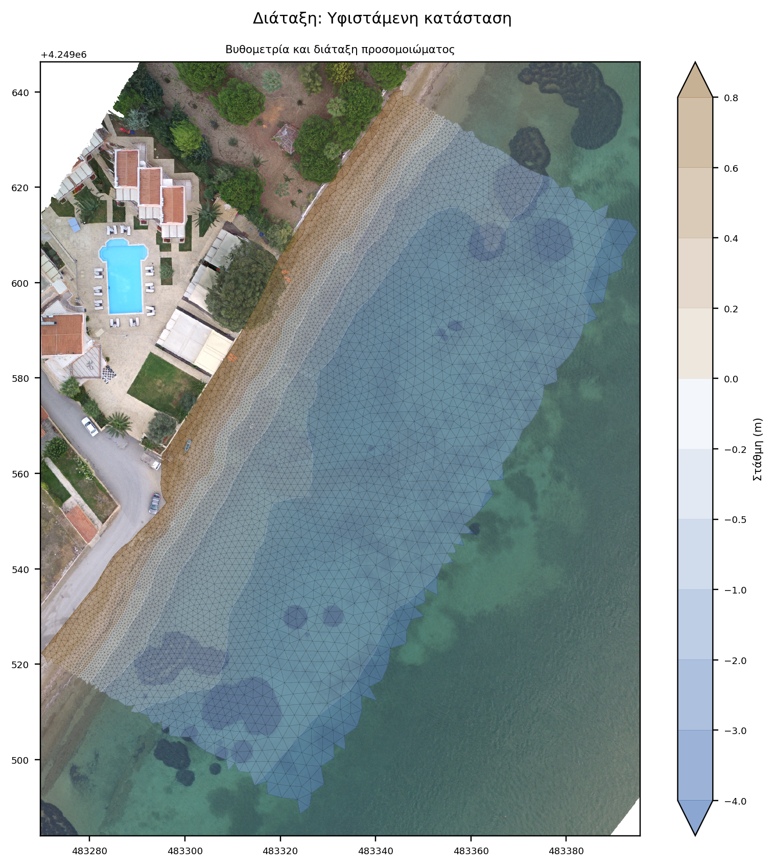
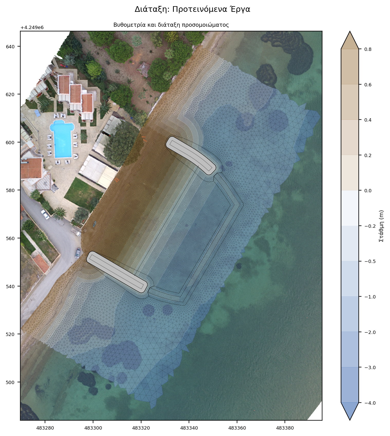
The hydrodynamic (TELEMAC2D), spectral (TOMAWAC) and sediment transport model (SISYPHE) spans the wider area of study, extending 950m along the coast of interest and 320m laterally. The use of a flexible mesh enables an increase in mesh density towards shallow water where coastal processes dominate and spatial resolution is a prerequisite. The variable mesh density enhances computational speed and therefore makes the model cost effective. The model comprises 23.000 nodes and 45.000 elements.
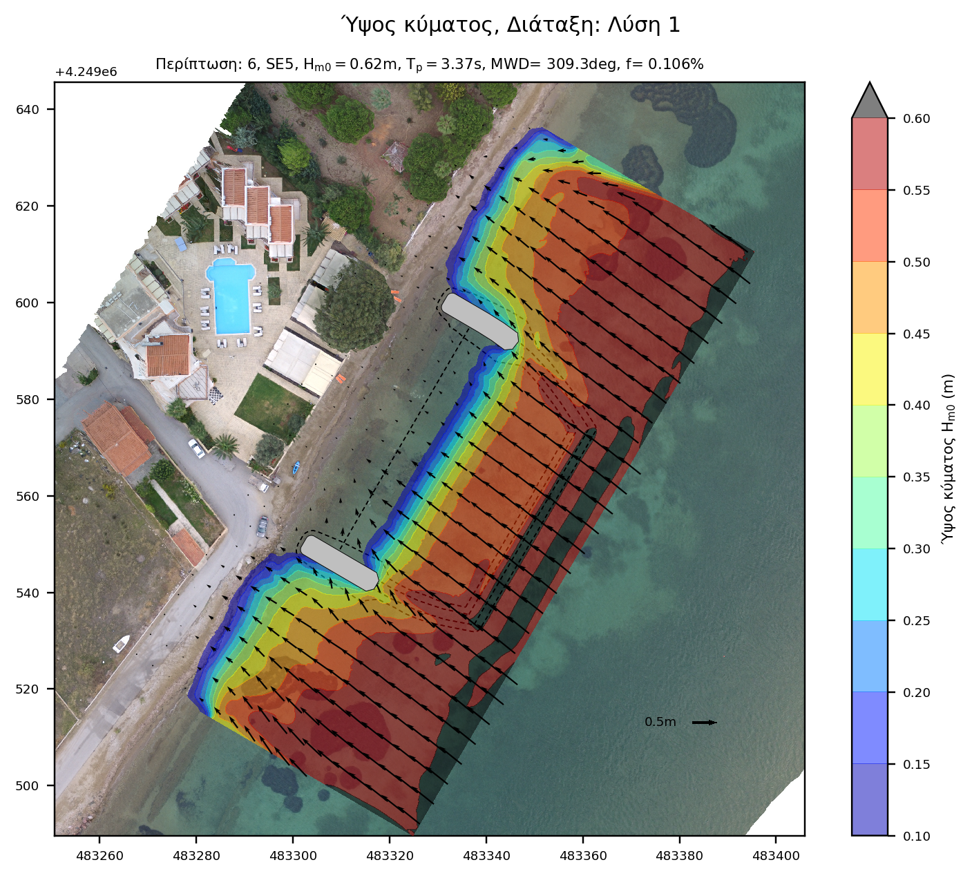
The wave disturbance model (ARTEMIS) is employed at close proximity to the works and is aimed at defining the wave field as a result of the structure interference. The model extends 140 along the coast and 75m laterally and is set up using an invariable 0.5m spatial resolution in order to accurately simulate the wave field around the structures. The model consists of 42.000 nodes and 83.000 elements.
Wave climate
The wind and wave climate of the project was taken from the Skiron and WAM models for the period 2001-2010.
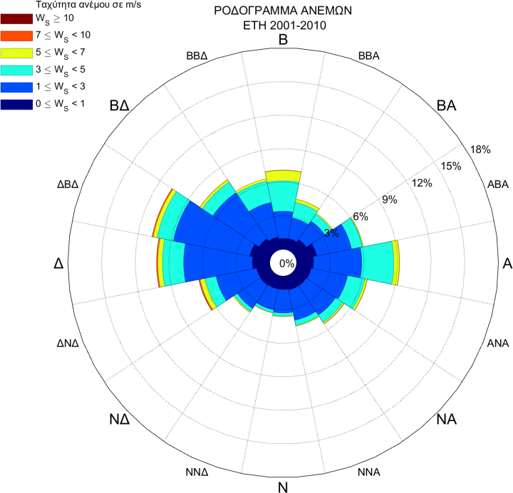
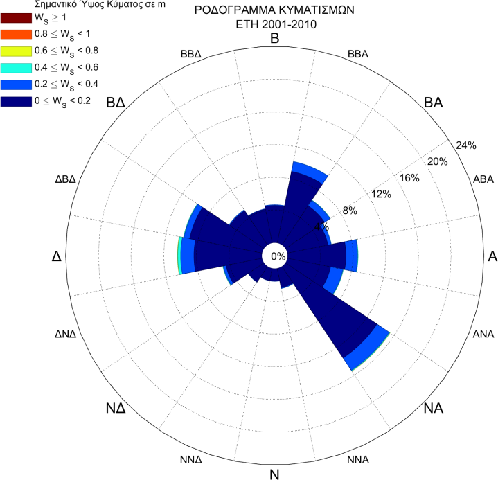
Initially, wave directions were divided into 45 ° sectors and wave height values were divided into 0.5 meter bins. Very low waves were excluded while very high were aggregated due to low frequency of occurrence. Wave cases were examined sequentially so that changes in bottom morphology are taken into account in the next case. The procedure was repeated 5 times, to simulate bottom change over 5 years.
Conclusion
The study optimized the layout of the exterior works, estimated the average annual volume of basin sedimentation and concluded that the proposed works do not adversely affect the existing sediment transport equilibrium.
The study proved the proposed works do not trap bypassing sand, instead they allow a mean annual dispersion of ~6m3 to the coastline at the lee, feeding sediment to an already starved budget. It is therefore concluded that the proposed works do not adversely affect the existing sediment transport equilibrium.