Sediment transport study for the Kefalos port expansion
The sediment transport study is supporting the project entitled "Improvement - Expansion of Port Facilities of the Port of Kamari Kefalos of Kos island", assigned to CNWAY in September 2017.
Objectives
The objectives of this coastal engineering study were:
- To address the ongoing siltation problem of the existing basin.
- Ensure that proposed port expansion projects do not adversely affect the adjacent coastline.
During the elaboration of the study, we did a detailed investigation and analysis of the existing conditions and designed appropriate response measures. Then we carried out a numerical simulation to evaluate and optimize the effectiveness of measures.
Numerical modeling
Offshore sediment transport was performed with the TMS (Telemac-Mascaret System) computing suite based on the coupling of individual models of wave propagation (TOMAWAC and ARTEMIS), wave-induced currents (TELEMAC2D) and sediment transport (SISYPHE).
Model parameterization requires the input of sediment grading, spatial distribution and availability, as well as the spatial distribution of the corresponding friction coefficients based on the seabed texture. The spatial distribution map was created by combination of remote-sensing techniques and an appropriate on-site survey and sampling program. Specifically, the following supportive activities were carried out:
- shoreline investigation
- seabed sediment sampling at varying depths
- bathymetric and topographic survey
- photographic documentation / Aerial mapping
- marine vegetation mapping
- wind-wave climate estimation
Meticulous parameterisation ensures more accurate modeling of physical processes, enhancing the reliability of the analysis results.
Numerical model characteristics
The model consists of 2 sub-models, 'offshore' and 'nearshore'. The 'offshore' extends from the offshore wave position (WAM wave model node) to the shore, and its role is to prescribe wave and current boundary conditions for the 'nearshore' model. The 'nearshore' model is a subset of 'offshore' and this nesting aims to reduce computational effort.
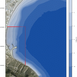
- Offshore model: It extends 3,1km along the N-axis and 1,8 km laterally. It covers an area of approximately 3,4 km2 and consists of 75,000 elements and 39,000 nodes.
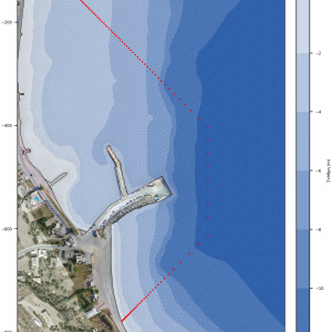
- Nearshore model: It extends 1000 meters along the N-axis and 500 meters laterally. It occupies an area of approximately 390 acres. and consists of about 43,000 elements and 22,000 nodes.
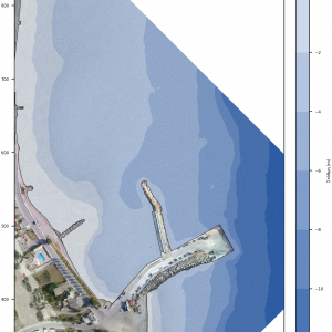
- Wave disturbance model: It extends 700 meters along the N-axis and 370 meters laterally. It covers an area of about 140 acres. and consists of about 148,000 elements and 75,000 nodes.
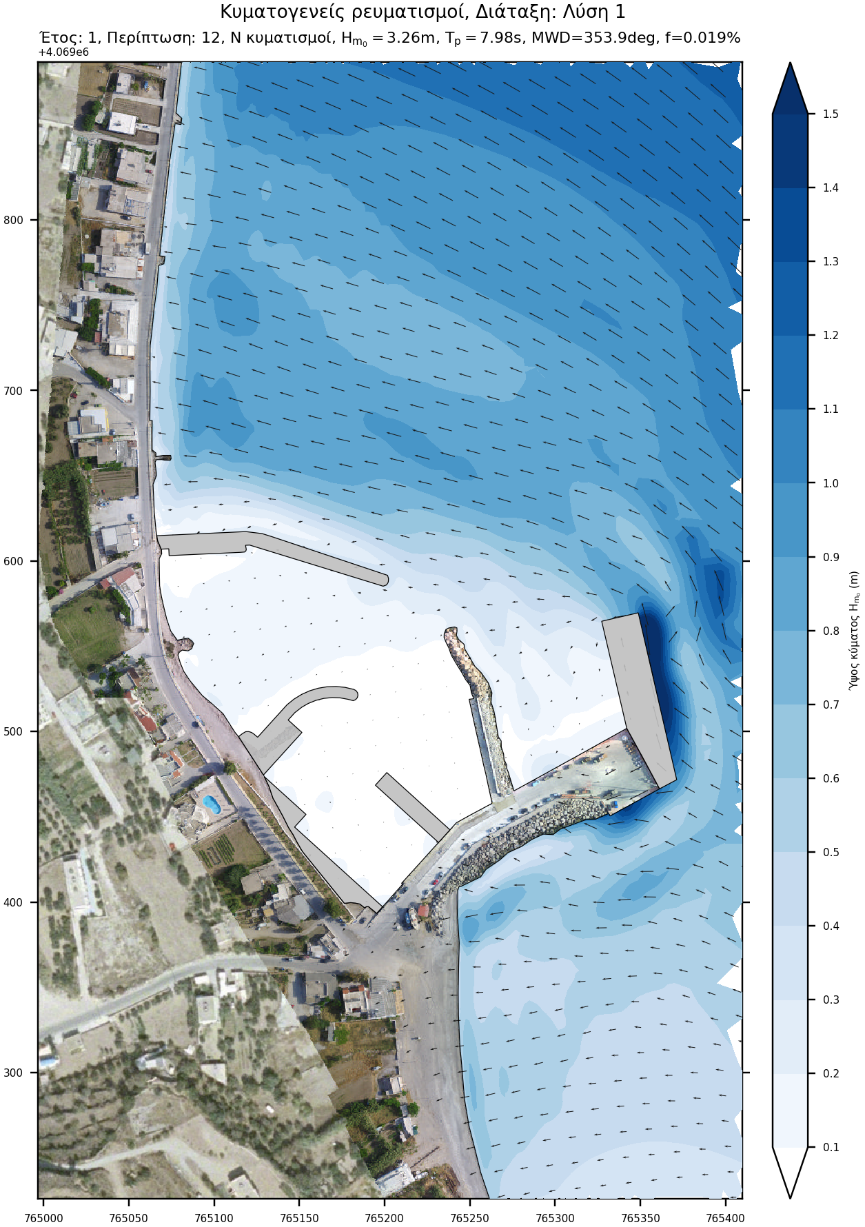
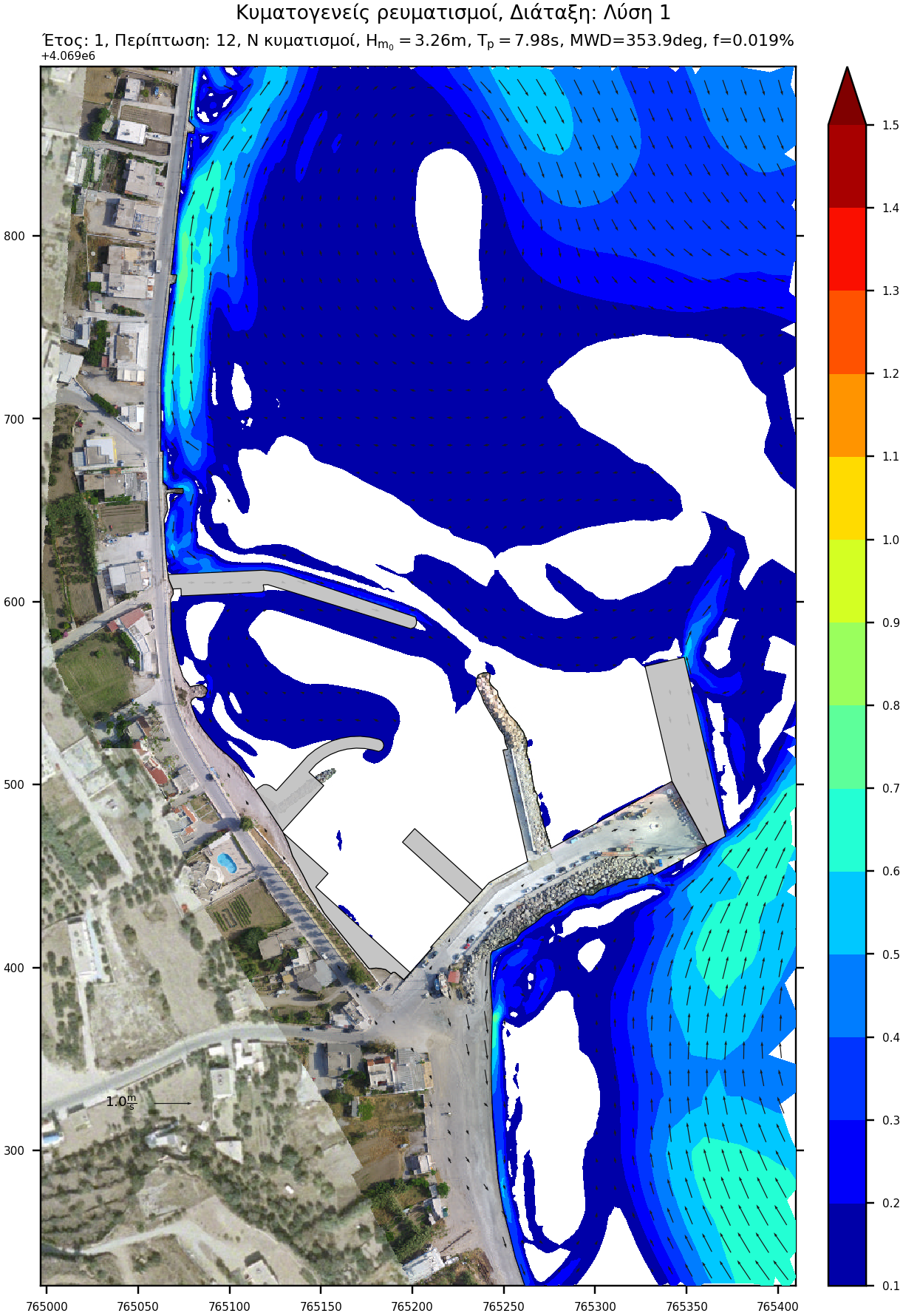
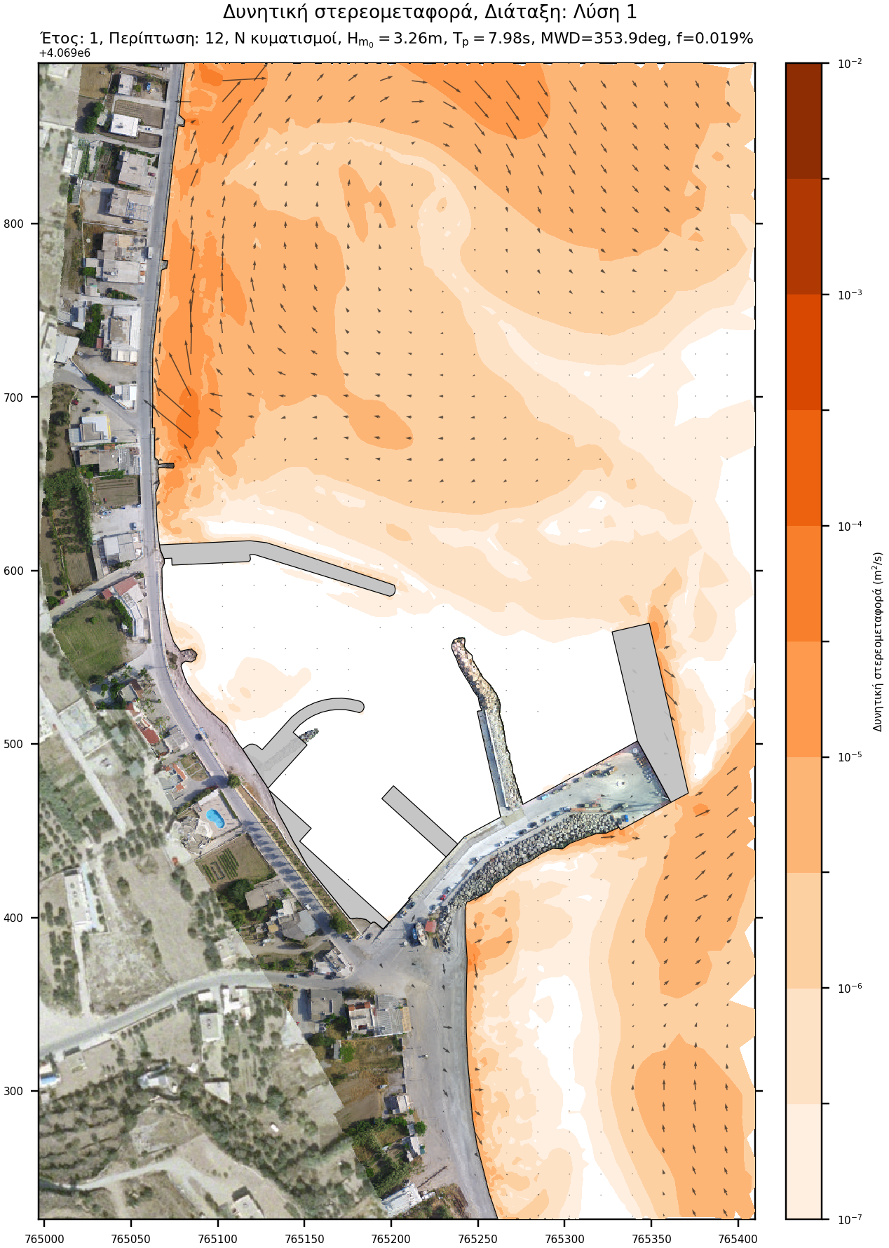
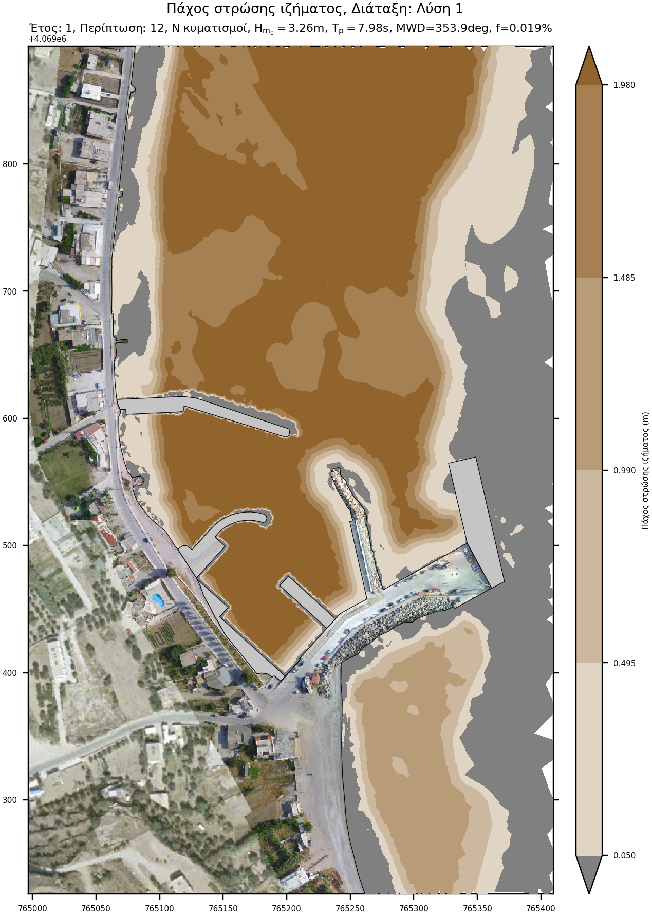
Wave climate
The wind and wave climate of the project is derived from the Skiron and WAM model respectively for the period 2001-2010.
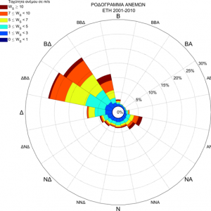
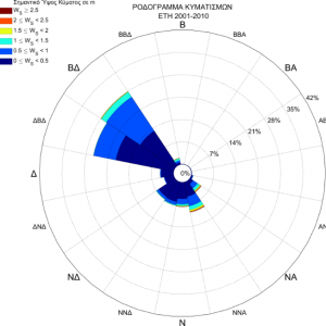
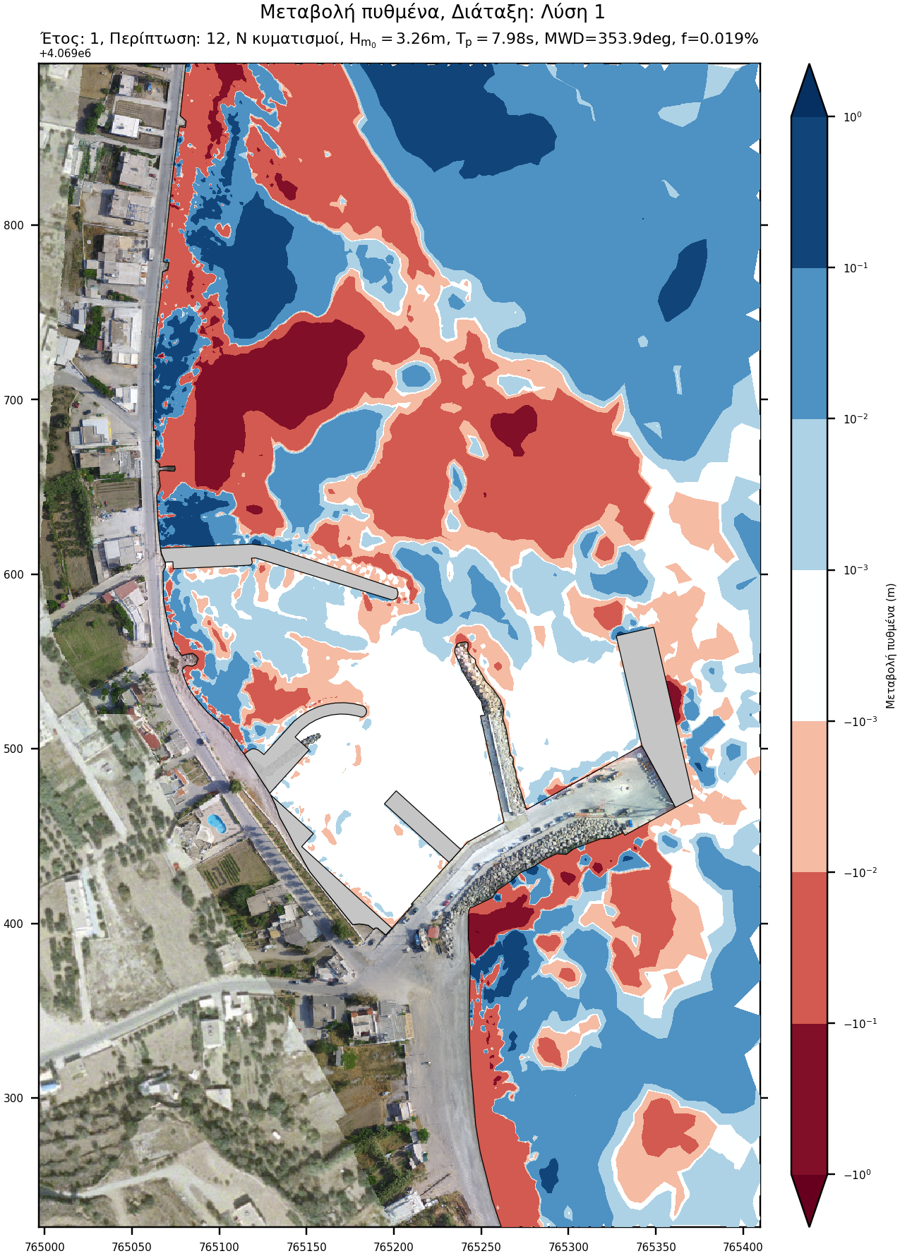
Initially, wave directions were divided into 45 ° sectors and wave height values were divided into 0.5 meter bins. Very low waves were excluded while very high were aggregated due to the very low frequency of occurrence. The wave cases were examined sequentially so that changes in bottom morphology are taken into account in the next case. The procedure was repeated 5 times, to simulate bottom change over 5 years.
Conclusion
According to the numerical model results, the proposed measure fully address the siltation issue of the basin. The predicted change in sediment budget equilibrium concerns the shift of the existing sedimentation pattern upstream of the new groyne, where extensive erosion currently takes place. Therefore, the accretion locally counteracts the problem of erosion.