Marmari Port – Evia Island
Marmari is the second largest town, in population, of South Evia Island, following Karistos. The formation of the homonymous gulf, along the southwest coastline, together with the presence of Petalioi Islands, right across in the west, create a relatively protected natural harbor that is in continuous use since the ancient years. Today, the port facilities of Marmari serve the maritime connection between the greater area of South Evia and Rafina, Attica. However, over the last years, the transportation needs have risen and the existing infrastructure cannot “respond” to them. In view of the above and in 2002, the former Harbor Treasury of Marmari Port contracted, after holding a contest, consultant engineer Albert Paul Yamin, the design of expansion and upgrade works of the port.
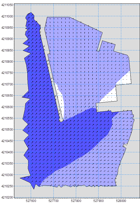
In order to review the design of the new works as of the impact they would have on the shape of the coastline, a sediment transport study was implemented. The identification of the coastal area that took place included, apart from in situ observations, the sampling and sieve analysis of seabed material in order to determine its grain size. These actions were followed by the calculation of the offshore wave characteristics and the preparation/implementation of the sediment transport simulation along the coastline, before and after the construction of the new works.
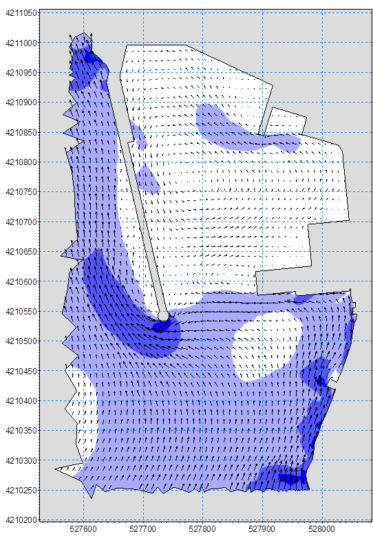
The results of the study showed that the presence of the new works causes a tendency of sedimentation both in the entrance and in the navigation channel of the port. This tendency is observed during the blowing of south, southwest and west winds with intensity equal or greater than 5bf. In order to face the problem mentioned before, it was proposed to remove the sediment from the area every 5 to 20 years.
Study facts:
• Estimation of offshore wave characteristics using JONSEY model from Seaworks marine software suite
• Simulation of coastal sediment transport using the MIKE numerical mode suite and, specifically, models of setting the land-boundaries (coastline) and the water depths (ΜΙΚΕ21 PP), calculating local wave characteristics (MIKE21 NSW), wave induced currents (MIKE21 HD) and sediment transport (MIKE21 ST)
• The area of simulation includes the whole Marmari Gulf
• Implementation of simulation for two layouts (existing and new)
• Examination of 4 wind directions, S, SW, W and NW for wind intensities of 3 and 5bf for each direction