Sediment transport study for the Kardamena port expansion
The sediment transport study is supporting the project entitled "Improvement - Expansion of Port Facilities of the Port of Kardamena of Kos island", assigned to CNWAY in October 2017.
Objectives
The objectives of this coastal engineering study were:
- To address the ongoing siltation problem of the existing basin.
- Ensure that proposed port expansion projects do not adversely affect the adjacent coastline.
During the elaboration of the study, we did a detailed investigation and analysis of the existing conditions and designed appropriate response measures. Then we carried out a numerical simulation to evaluate and optimize the effectiveness of measures.
Numerical modeling
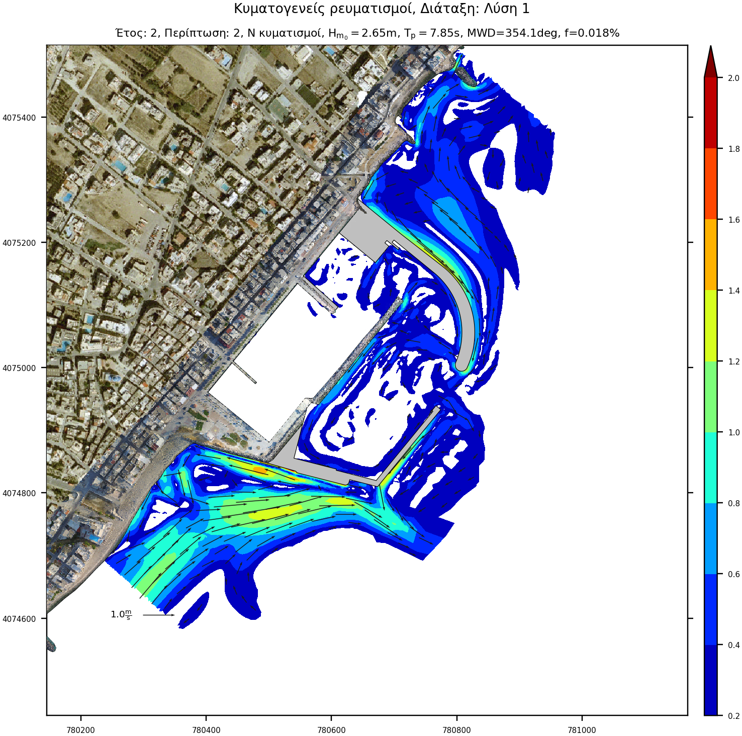
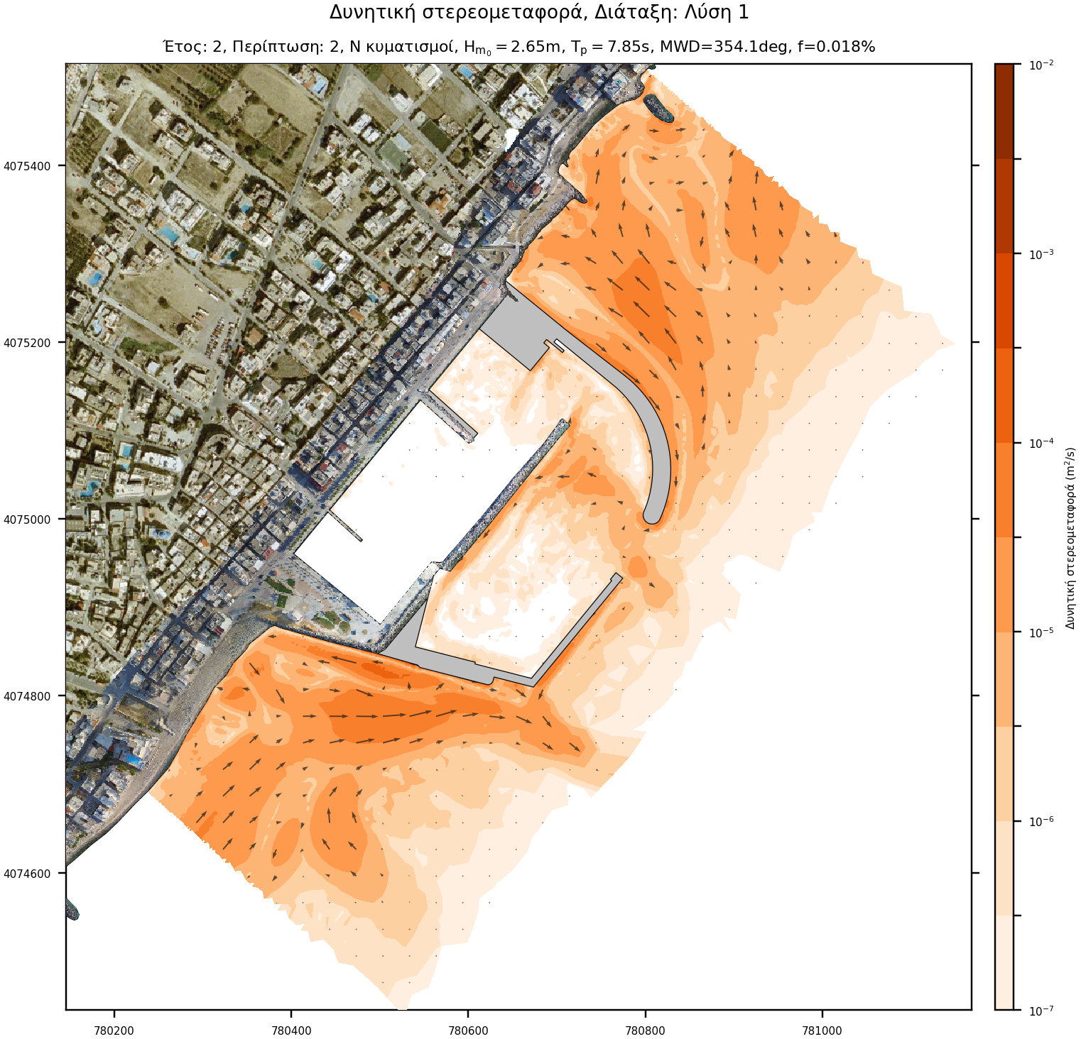
Offshore sediment transport was performed with the TMS (Telemac-Mascaret System) computing suite based on the coupling of individual models of wave propagation (TOMAWAC and ARTEMIS), wave-induced currents (TELEMAC2D) and sediment transport (SISYPHE).
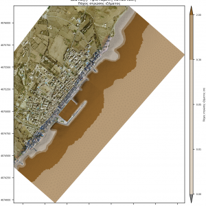
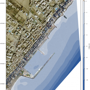
Model parameterization requires the input of sediment grading, spatial distribution and availability, as well as the spatial distribution of the corresponding friction coefficients based on the seabed texture. The spatial distribution map was created by combination of remote-sensing techniques and an appropriate on-site survey and sampling program. Specifically, the following supportive activities were carried out:
- shoreline investigation
- seabed sediment sampling at varying depths
- bathymetric and topographic survey
- photographic documentation / Aerial mapping
- marine vegetation mapping
- wind-wave climate estimation
Meticulous parameterisation ensures more accurate modeling of physical processes, enhancing the reliability of the analysis results.
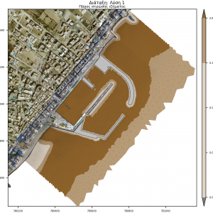
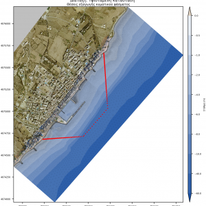
Numerical model characteristics
The model consists of 2 sub-models, 'offshore' and 'nearshore'. The 'offshore' extends from the offshore wave position (WAM wave model node) to the shore, and its role is to prescribe wave and current boundary conditions for the 'nearshore' model. The 'nearshore' model is a subset of 'offshore' and this nesting aims to reduce computational effort.
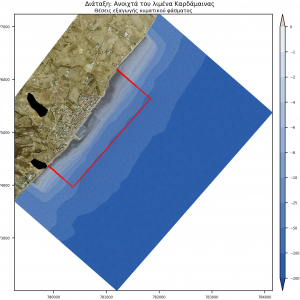
- Offshore model: It extends 4,5km along the coast and 2,5 km laterally. It covers an area of approximately 11,8 km2 and consists of 153,000 elements and 77,500 nodes.
- Nearshore model: It extends 2,2 km along the NE-axis and 600 meters laterally. It occupies an area of approximately 1,4km2 and consists of about 115,000 elements and 59,000 nodes.
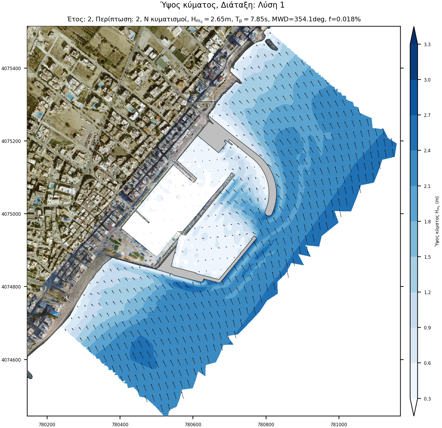
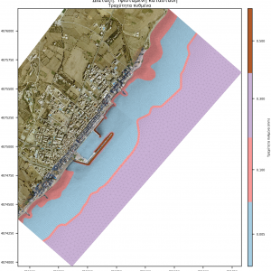
Wave climate
The wind and wave climate of the project was derived from the Skiron and WAM model respectively for the period 2001-2010.
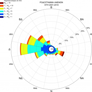
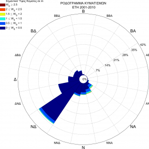
Initially, wave directions were divided into 45 ° sectors and wave height values were divided into 0.5 meter bins. Very low waves were excluded while very high were aggregated due to the very low frequency of occurrence.
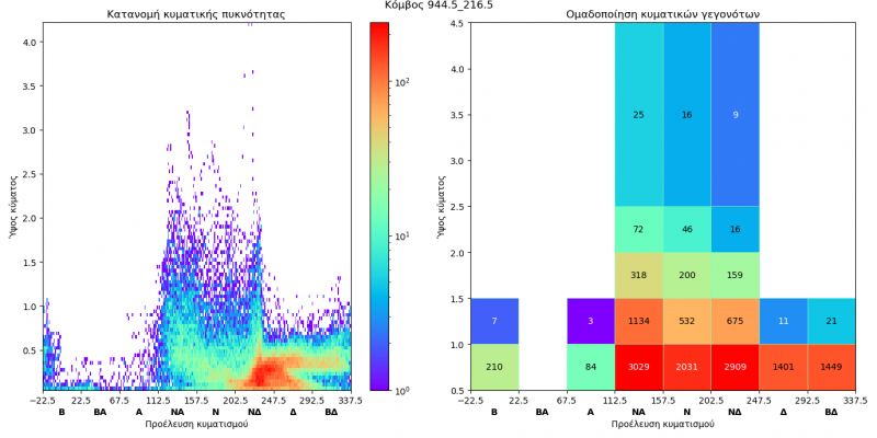
Subsequently, the directional sectors that did not affect the study area were excluded. For the remaining directional sector-wave bin combinations, the equivalent wave height (representative of the wave state on a yearly basis) was calculated.
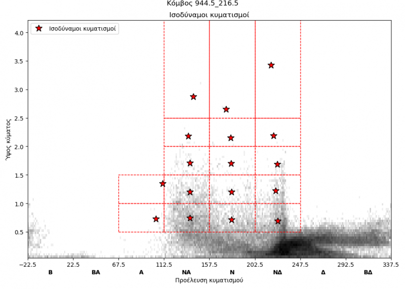
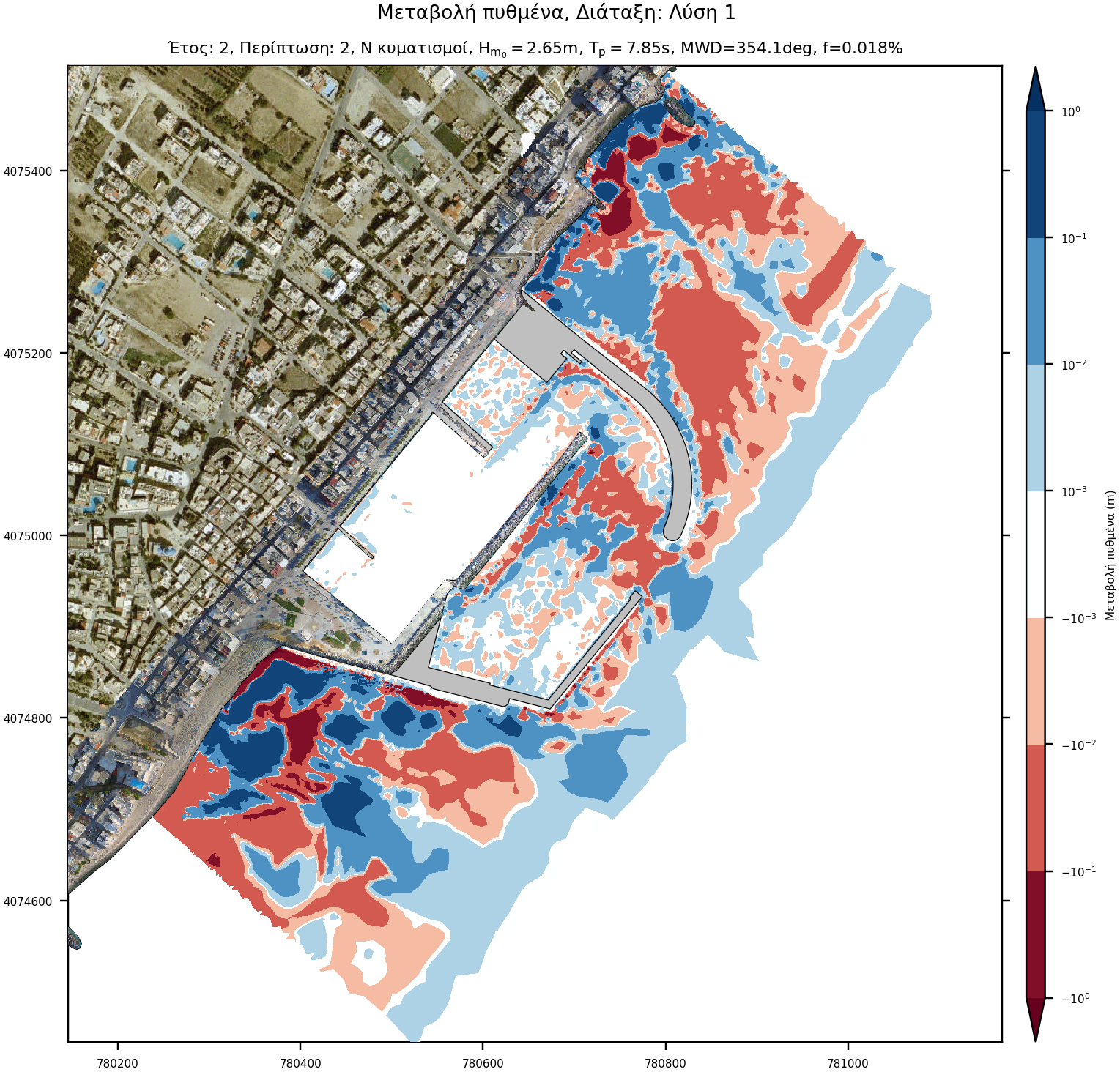
The wave cases were examined sequentially so that changes in bottom morphology are taken into account in the next case. The procedure was repeated 5 times, to simulate bottom change over 5 years.
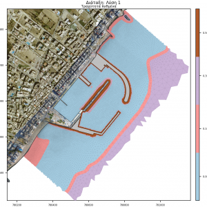
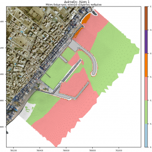
Conclusion
Coastal impact
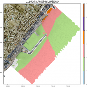
Based on the sediment transport study results, it is apparent that the coastal area under investigation is morphologically very active.
The existing port infrastructure disrupts the long-shore transport. As such it has already created a sediment deficit at the port lee side and ultimately leading to erosion. The proposed works extend further seaward and reduce sediment bypass even more. To prevent further erosion at the lee side of the proposed works, the study has shown that a total volume of 600m3 is required to be transported and deposited annually to the area where erosion is observed.
Port basin siltation
The approach channel orientation of the existing port entrance allows a sediment ingress and deposition of approximately 76 m3 on an annual basis in the port basin. The layout of the proposed works prevents sediment import as the sediment entering the respective area is zero. At the entrance of the port, the siltation rate is estimated to be approximately 32 m3 annually, however, operational efficiency is unlikely to be hindered due to the large volume of the basin.