New Port of Chios Island
The main port of Chios serves the maritime connection of the Island from the ancient years. The layout, as it stands nowadays, was constructed at the end of 19th century, in order to serve the commercial transports of local products such as mastic, fruits etc. and generally, the famous merchant shipping of Chios. The historic port can, no longer, face the modern demands in goods and visitors transportation. These new conditions had led to the need of constructing new harbour works, in a different location, due to the noticeable difficulties of expanding the existing ones.
Thus, in 2003, the Prefecture of Chios, assigned a consortium led by companies SALFO SA and KANON SA, the study of the new works, located opposite to the airport. CNWAY realized the main design of the harbour, as a subcontractor, and prepared the wave disturbance study as well, using numerical model simulations. These simulations would give an exact determination of the wave conditions in the entrance and inside the basin of the port.
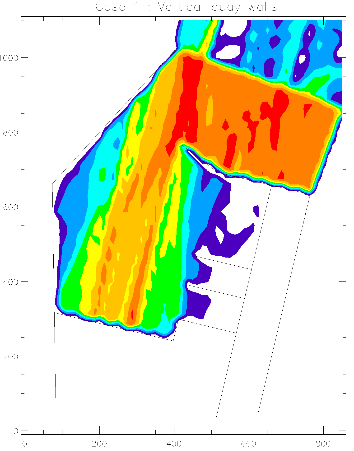
The determination of wave conditions inside the basin of the new works was realized by implementing a scale simulation model at the Laboratory of Marine Works of the National Technical University of Athens. However, in the course of events, it was proposed to replace the armoring of part of the land area, used to serve the port’s facilities, with vertical quay walls in order to increase its total capacity. This change was expected to modify the wave disturbance inside the basin and a review of the wave conditions was required, using numerical simulation models. CNWAY prepared the respective study of wave disturbance.
The results showed that the replacement of armoring with vertical quay walls did not have any particular consequence on the wave conditions that where estimated by the implementation of physical simulation model. Generally, the proposed windward mole offers total protection to the basin from north and northeast waves when the respective winds, of high annual frequency, are blowing. Actually, a significant wave disturbance, in the basin, is noted only when east and southeast winds are blowing, due to the same, southeast orientation of the port entrance. The annual frequency of those winds is rather small but they create a wave height up to 1.90m, both near the entrance and in the basin as well, which is not acceptable for port’s operation. In order to face the problem, it was proposed to use absorbent quay walls so that the wave height would diminish (1.10m near the entrance and 1.30m inside the basin).
Study facts:
• Estimation of offshore wave characteristics using JONSEY model from Seaworks1 marine software suite
• Calculation of local wave characteristics southeast of the new port Gulf using the numerical model MIKE21 NSW from DHI software suite with a mesh dimension 15mx15m
• Simulation of wave disturbance by the numerical PORTRAY from Seaworks3 marine software suite with a mesh dimension 12.5mx12.5m
• Three dimensional display of sea bed using Land Development Desktop from Autodesk
• Implementation of simulation for two occasions: the first refers to the use of classic vertical quay walls and the second refers to the use of absorbent quay walls
• Examination of four (4) wind directions as follows: north (9bf), northeast (9bf), east of an intensity (8bf) and southeast (8bf)