Marmari Port - Evia Island
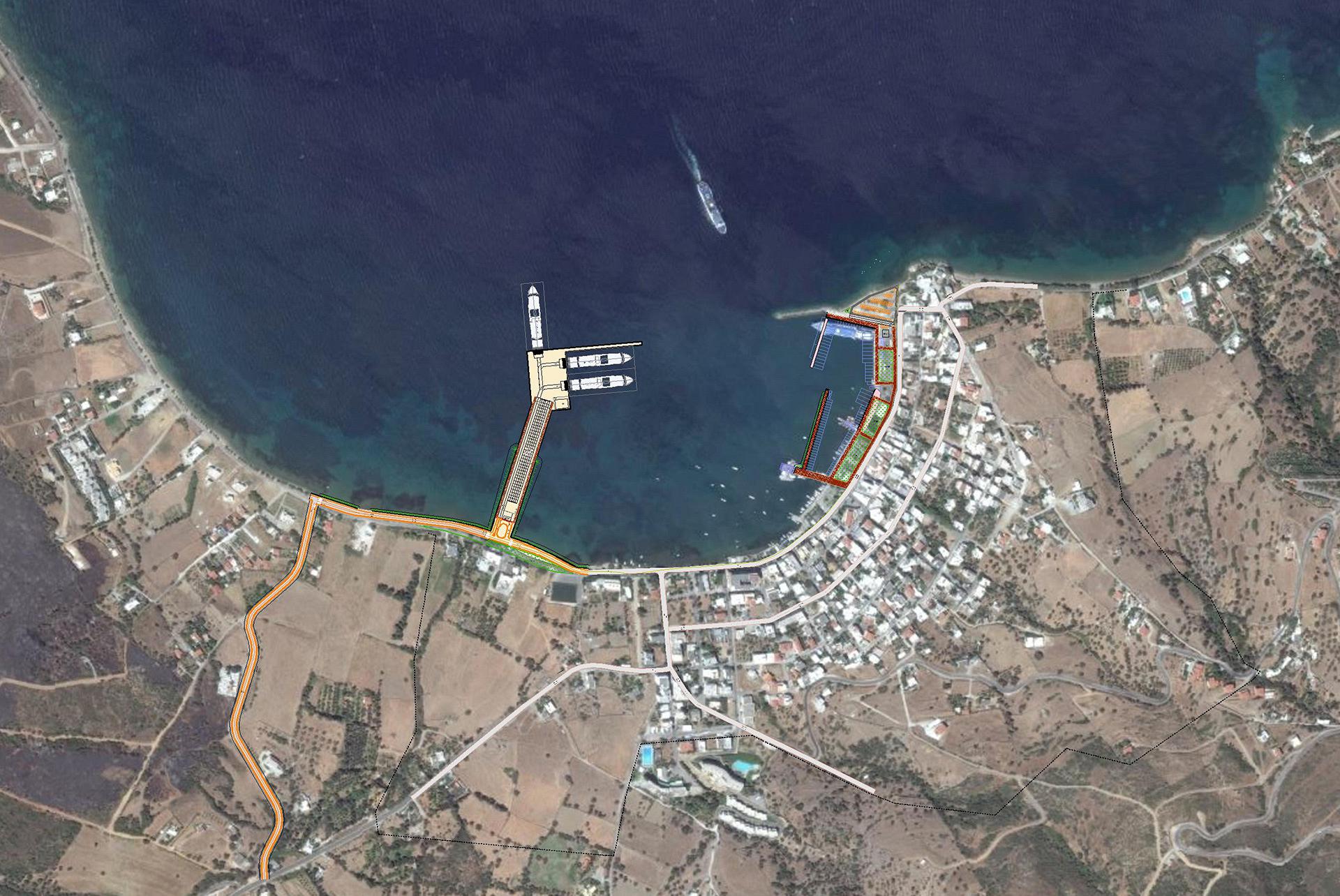
Marmari Port is located on the south west of Evia Island, at the north side of Marmari Bay. It connects south Evia with Rafina Port (Attica), serving as a sea gate for vehicles, passengers and goods headed to south Evia. The port operates in the northern end of Marmari town and it is characterized by inadequate marine facilities and problematic road access. Along the coast and the sea zone of Marmari a great number of fishing and pleasure boats are moored, with no real protection from waves and without basic services.
The Marmari Port Authority under the supervision of the Department of Public Works of former Evia Prefecture and current Regional Evia Unity contracted in 2012 CNWAY for drafting a long to medium term Master Plan for the port. The Master Plan was approved by the Planning Commission and Port Development (ESAL) on February 2013.
Master Plan Facts:
- Estimated construction cost for phase A (main port facility): 11,460,000 €
- Estimated construction cost for phase B (Small fishing and tourist harbor): 3,570,00 €
- Estimated construction cost for phase C (Access road infrastructure ): 1,170,00€
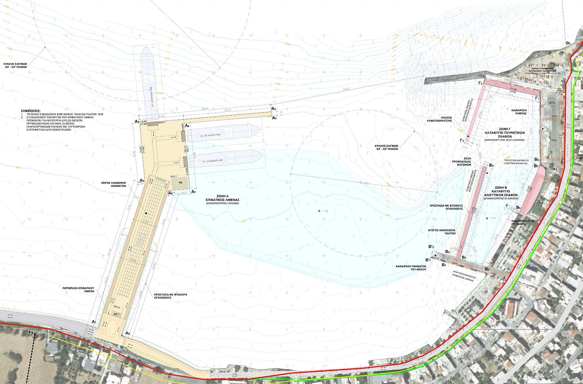
- Port Capacity after the expansion
- Three (3) ROPAX berths for 100m long vessels, (one external and two inside the port) and two service buildings with a total of 350 sq.m.
- Marshaling yard with a capacity of 180 vehicles
- 275 m of new quay walls
- Total of 13,895 sq.m. of new port land area
- Small fishing harbor capacity: 64 boats up to 20 meters
- Small tourist harbor capacity: 37 boats up to 20 meters with a service building of 120 sq. m.