Marathokampos Fishing Harbour – Samos Island
Marathokampos is a very important coastal village of south Samos and its fishing port is used as a shelter by the majority of local fishing fleet. However, the existing facilities face a lot of operational problems. The service of flying dolphins, excursion boats etc. is latently covered by a small jetty which cannot offer, by any means, their simultaneous berthing. In addition, the port presents a significant problem of sedimentation, both in the entrance and its basin. This is caused mainly by the inadequate protection of the basin from strong south and southeast waves and it results in the remarkable decrease of the marine infrastructure functionality. The design of new external and internal works was directly required, in order to provide an efficient upgrade of the existing port as well as to solve the rest of the problems.
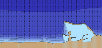
The effectiveness of the new works on addressing the sedimentation phenomenon was evaluated by a respective sedimentation transport study that was assigned to CNWAY, in 2006, by the Prefecture of Samos. The geomorphological identification of the coastal area was done by in situ observations, sampling of seabed material, followed by sieve analysis, in order to determine the grain size. These actions were followed by the calculation of the offshore wave characteristics and finally, the preparation/implementation of the sediment transport simulation along the coastline, before and after the construction of the new works.
The results of the study showed that the new external works deal effectively with the sedimentation problem. The expansion of the existing windward mole offers a good protection from the south and southeast winds while the proposed groin diverts the sediment from the entrance and “traps” a great amount of it in its north side. The presence of the groin together with the periodic removal of the trapped sediment keep the entrance “clear” and maintain the smooth function of the new works.
Study facts:
• Estimation of offshore wave characteristics using JONSEY model from Seaworks marine software suite
• Simulation of coastal sediment transport using the MIKE numerical mode suite and, specifically, models of setting the land-boundaries (coastline) and the water depths (ΜΙΚΕ21 PP), calculating local wave characteristics (MIKE21 NSW), wave induced currents (MIKE21 HD) and sediment transport (MIKE21 ST)
• Total simulation area of 1.2 square km
• Implementation of simulation for two layouts (existing and new)
• Examination of three (3) wind directions, E, SE and S, for wind intensity of 5bf for each direction