Kardamyla Fishing Harbour – Chios Island
The port facilities of Kardamyla, in Marmaro Gulf, along the north coastline of Chios, serve the fishing boats of the greater area, while, during the summer, they offer berths for bypassing tourist boats as well. Nevertheless, they present significant operational problems. The existing windward mole does not intercept efficiently the north waves that directly affect the area and an important length of the quay walls is considered rather shallow due to deposition of the sediment that is carried by a torrent which flows into the basin. Thus, in 2008, the former Municipality of Kardamyla, after holding a contest, assigned CNWAY the design of improvement works that would insure the safe berthing of fishing and tourist boats as well as the future maritime connection of North Chios with Mytilene by ferry (Kardamyla – Plomari maritime route).
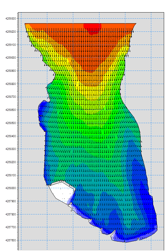
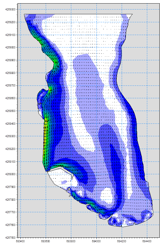
In order to determine the impact of the new works on the shape of the Marmaro Gulf coastline, a sediment transport study was required and implemented. The geomorphological identification of the coastal area was done by in situ observations and bibliographical research. These actions were followed by the calculation of the offshore wave characteristics and the preparation and implementation of the sediment transport simulation along the coastline.
The results of the study showed that the new works do not affect, in any significant way, the sediment transport equilibrium of the area, both northwest and southeast. However, their design is very effective in stopping the sea currents and the sediment transport inside the basin and, at the same time, it facilitates its removal.
Study facts:
• Estimation of offshore wave characteristics using JONSEY model from Seaworks marine software suite
• Simulation of coastal sediment transport using the MIKE numerical mode suite and, specifically, models of setting the land-boundaries (coastline) and the water depths (ΜΙΚΕ21 PP), calculating local wave characteristics (MIKE21 NSW), wave induced currents (MIKE21 HD) and sediment transport (MIKE21 ST)
• The simulation area includes the whole Marmaro Gulf
• Implementation of simulation for two layouts (existing and new)
• Examination of north wind direction and wind intensities of 9 and 5bf